I signed up to do a local trail run for a charity event with my sister and a friend Tracy on Sunday – we woke up and arrived early to register the day of the event and I knew the parking lot was small so I wanted to make sure we got a decent spot. The run was going to be a 10k – what I didn’t know was that the route would take us up every single steep incline that was in the forest.
Month: June 2016
Charles Mound – Illinois State Highpoint – Road Trip Day 9
They were calling for rain again so we headed out as early as we could. Again we put ourselves within about an hours drive of Charles Mound, the highest point in Illinois so we could snag it first thing in the morning and then continue our drive home. I was expecting there to be a lot of people there as well as this highpoint is on private property and only open a handful of days during the year.
I typed in 688 West Charles Mound Rd, Scales Mound, IL and my GPS took us right to the gate. It was closed with a chain around it, but there were signs directing us to park and continue on foot. My dad parked off the road as far as possible and as we were putting on our hiking shoes a truck pulled up and a man inside warned us to be careful because where we parked there was a big drop off that was hidden in the tall grass. He also stated it looked like it was gonna be a busy day – it was around 8AM or so and there were already a few cars parked besides ours. The man in the truck turned and drove down the lane next to the gate for the highpoint so we are assuming it was Mr Wuebbel who owns the property but he didn’t introduce himself so I am not sure.
Hawkeye Point – Iowa State Highpoint – Roadtrip Day 8
From Sioux Falls, SD it was maybe a little over an hour drive to Hawkeye Point – the highest point in Iowa. We set out early because the weather predicted storms and we were hoping to catch a tiny window before the rain. Actually we ended up driving through the rain and got ahead of the storm as we reached the highpoint.
I plugged in 5467 130th St Sibley, IA into the GPS which is the address I found on roadsideamerica.com and it took us right there. It was very easy to get to and since everything is so flat we could see the silo and flags in the distance (as well as the approaching rain) as we drove closer. For some reason my GPS took us off the main road and down some dirt roads the back way to the entrance, but either way works.
Road Trip Day 7
We started the long drive back east – we needed to be at the Illinois highpoint on Saturday because it is on private property and only open to the public a few days a year. We looked at a map and figured out ways to split up the rest of the trip so it would put us close to the Charles Mound Illinois Saturday morning so we could continue back to PA. More on that in the next few posts!
Along the way east we drove through the Badlands National Park – I think it is so beautiful here and we had nice weather (unlike last year when it was rainy and very foggy!) The bison are always awesome to watch and the prairie dogs are too cute!!
White Butte – North Dakota State Highpoint – Road Trip Day 6
I can see for miles and miles,
I can see for miles and miles,
I can see for miles and miles and miles and…ok you get the point…I just kept hearing this song by The Who as we drove from Rapid City to Amidon, ND on the way to the high point White Butte. The drive was BEAUTIFUL – you really could see for miles in every direction as the landscape was pretty flat – and we also saw a rogue cow running down the road. Poor guy got out of his pasture somehow!
We followed these instructions from Summitpost.org:
From Amidon, ND:
– Go E on US 85 for 2.0 miles to an unmarked gravel road.
– Turn S (R) on the road and continue on for 5.0 miles to another gravel road.
– Turn W (R) and continue 1.2 miles to the VanDaele’s farmhouse.
There is actually a sign pointing towards the highpoint from 85, but I read on another blog that the road wasn’t the best so we opted to go to the next road, which follows the instructions above. It brings you right to the donation box at the start of the trail. After you place your donation (I read online $10 is the standard amount – the box has a padlock, but it’s open a bit on one side so you can slide the donation in) you can drive down the lane to the gate, but the road is really rutted out so it’s not recommended. Believe me, this would be really tricky to drive down even in an SUV, plus it only adds 2 miles round trip to an already pretty short hike, and the views are gorgeous walking down the lane – ENJOY THEM!
Road Trip Day 5 – Rapid City, SD
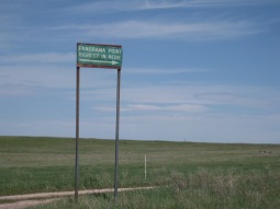
After reaching Panorama Point, we continued to Rapid City, South Dakota to hang out for a few days – if you have been reading my blog for a while, you know I was in Rapid City last year to see the sights and hike Harney Peak which is the South Dakota high point. My dad had never been to the area so we spent some time exploring.
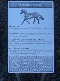
I LOVE this metal art in the town we drove through on the way to the Crazy Horse Memorial.
Panorama Point Nebraska Video
Here is a video I put together of the drive down the lane from the donation box to Panorama Point – the highest point in Nebraska! Enjoy!
Panorama Point Nebraska State Highpoint – Road Trip Day 4
On day 4 of our road trip my dad and I got up early and drove to Panorama Point in Nebraska. I took a screen shot of the directions from summitpost.org because I knew this highpoint was in the middle of a field so I wasn’t sure how much cell reception I would have. The instructions from that web site were perfect and took us right to the highpoint.
From I-80 in NE:
-Take Exit 8, just East of the WY-NE border
-Go S on CR 17 for 10.0 miles until dead-end
-Turn W (R) on CR 8 and continue for 4.2 miles
-Turn S (L) on CR 9 and continue for 1.0 miles
-Turn W (R) on CR 6 and continue for 2.0 miles
-Turn S (L) on CR 5 and continue for 2.0 miles
-Turn W (R) on dirt road with sign, cross double cattle guard (for bison!) and continue for 1.0 miles to a bend to the right (NNW), and continue0.2 miles to the highpoint marker
The road heading back is not paved – expect gravel and stones. You could hear the constant “PING” of them hitting the car and an occasional “KLUNK” of a larger rock. I was holding my breath the whole time – especially near the end where there were a few ruts in the road, making it tricky to drive, but we made it!
This is on private property and the owners ask for a $3 per person donation to visit the summit. There are envelopes and a donation box right at the start of the lane. The owners ask you to not hike down the lane because of Bison on the property (note the strips you have to drive over which Bison will not cross.)
Road Trip Days 1-3
“Do you realize we have driven for 3 days and over 1500 miles and still didn’t get to any of the state highpoints yet?” my dad pointed out.
It was true – my Dad and I planned a road trip and we were supposed to go to Michigan, Wisconsin, Minnesota and Illinois to visit those highpoints, but they were calling for some crazy storms in that area so we decided to just keep driving and hit Nebraska, North Dakota, Iowa and Illinois instead.


